Buying waterfront on Siesta Key should feel exciting, not confusing. Yet terms like deep water, no fixed bridges, and MLLW pop up in every listing and can change your boating, your insurance, and even your resale value. If you want a home that truly fits how you plan to use the water, you need to understand what these phrases mean here on the Gulf Coast. This guide breaks down the vocabulary in plain English and shows you how to verify the details before you buy. Let’s dive in.
Waterfront types on Siesta Key
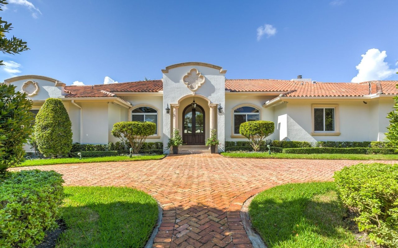
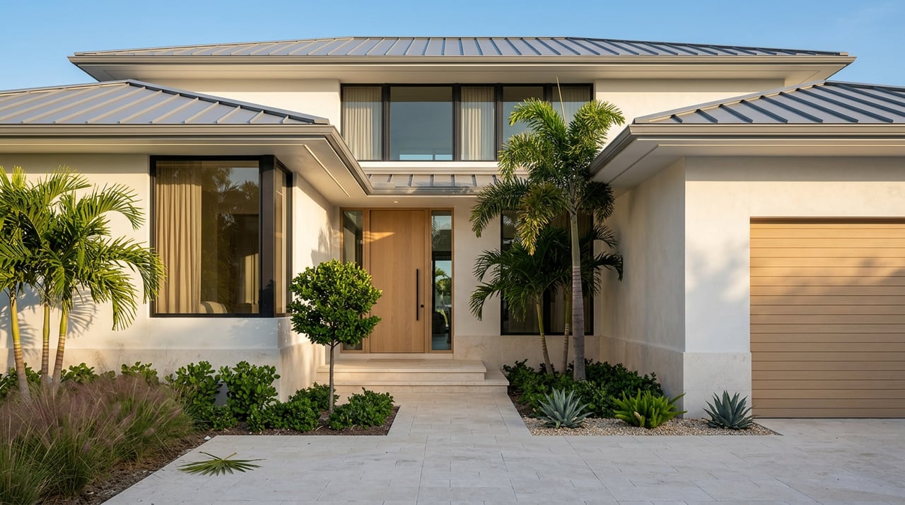
Gulf-front homes
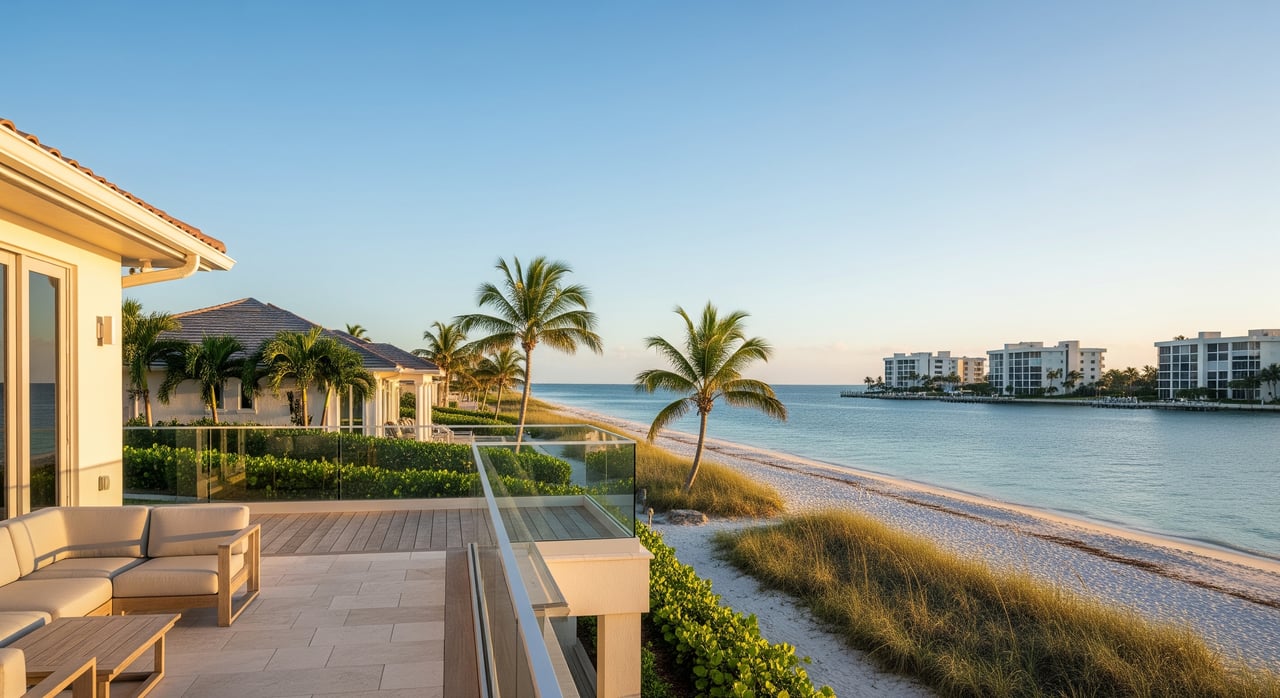
Gulf-front properties face the open Gulf of Mexico. You get direct beach access, sweeping views, and a very private shoreline experience depending on public access points nearby. These lots see stronger surf and salt exposure, along with greater storm surge risk and coastal erosion dynamics.
For boating, Gulf-front homes usually do not have private docks on the beach side. Your boating will often happen from a bay or canal slip, or at a marina. Factor in permitting rules and coastal setback lines if you plan to add or modify any shoreline structures on a Gulf-facing lot.
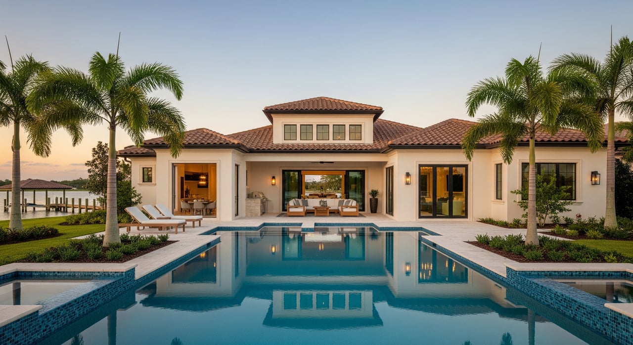
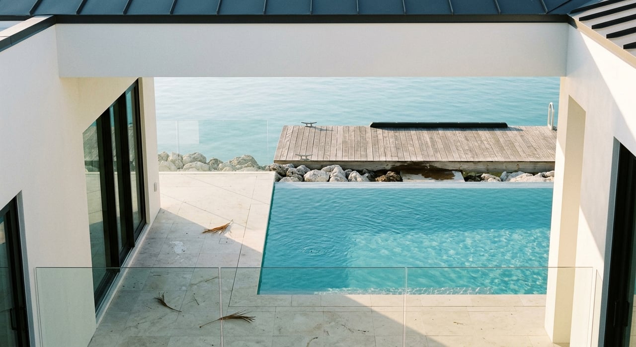
Bayfront homes
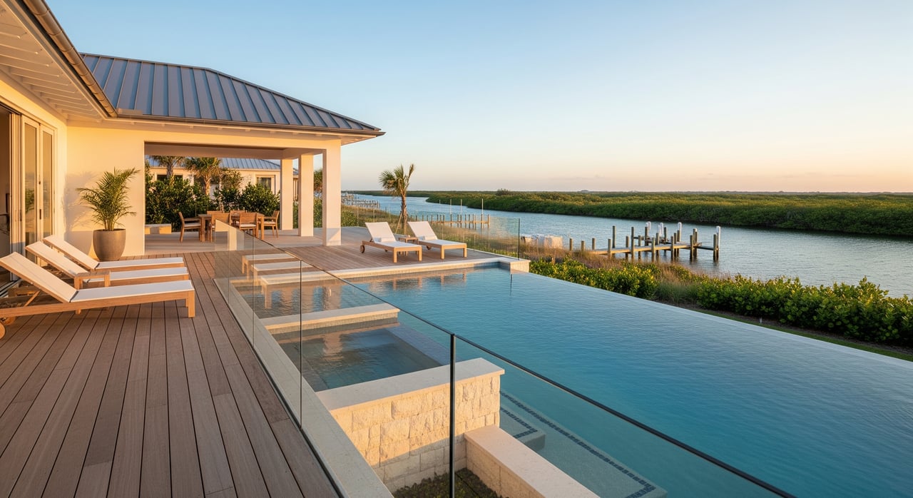
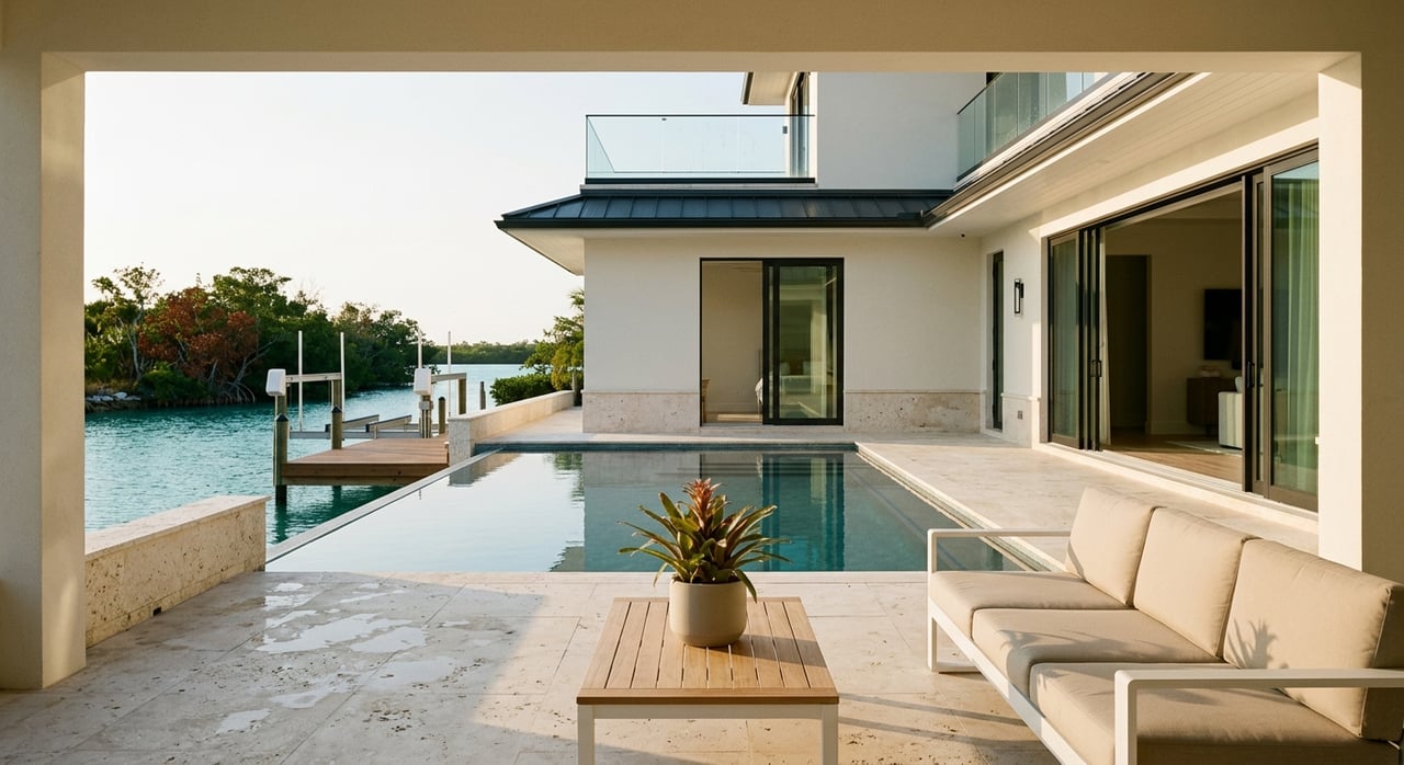
Bayfront homes face Sarasota Bay, which generally offers calmer, shallower waters. This is ideal for kayaking, paddleboarding, fishing, and wildlife viewing. Many bayfront parcels include mangroves or tidal flats that affect where a dock can be placed and what kind of boat draft the site can handle.
If you plan to keep a larger vessel, confirm documented depths at low tide along the entire route to open water. On Siesta Key, seagrass and manatee protections are common and may influence dock design and boating speeds near shore.
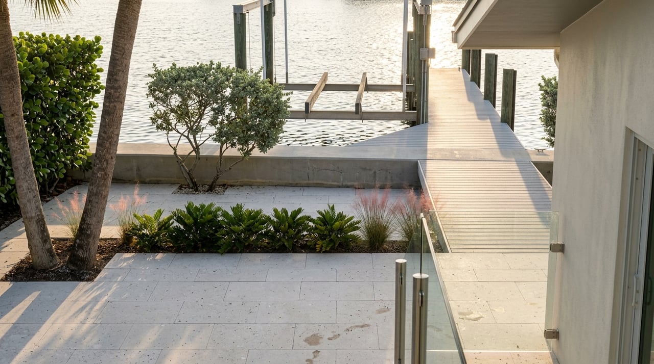
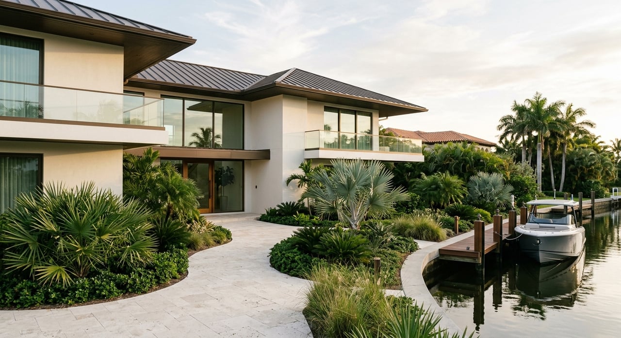
Canal and waterway-access homes
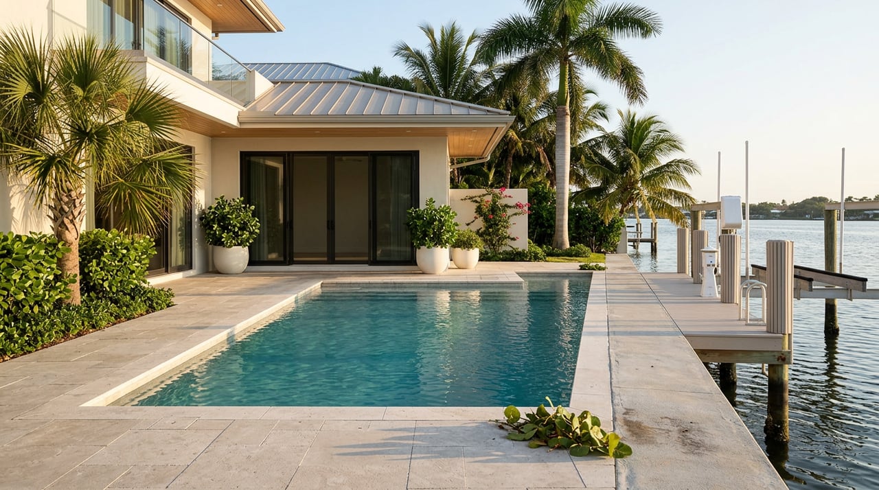
Many Siesta Key neighborhoods feature canals connected to Sarasota Bay. A private dock on a canal can give you quick access to the bay, but depths vary and siltation can occur over time. Your route to the Gulf might include fixed or movable bridges that limit air draft for taller boats.
Ask whether the canal is publicly maintained or privately dredged, who pays for dredging, and when it was last performed. If your dream is a 40-foot express cruiser, confirm both water depth at low tide and bridge clearances on your route.
Intertidal and mangrove frontage
Some parcels front mangroves, seagrass beds, or tidal flats. These sensitive environments are protected and may require special permits or mitigation for any dock, lift, or seawall work. Expect careful review of placement, materials, and impacts on habitat.
If you love paddling, birding, and a natural shoreline, these lots can be a great fit. If you want a large powerboat at your own dock, you will need detailed depth surveys, environmental review, and agency approvals to determine what is feasible.
Navigation terms that shape access
Mean Lower Low Water and Mean Low Water
Depths are only meaningful when tied to a tidal reference. Mean Lower Low Water (MLLW) and Mean Low Water (MLW) are standard tidal datums used on charts and surveys. When a listing says “4 feet at the dock,” you need to know which datum was used.
In practice, nautical charts often reference MLLW. For buying, request documentation that states the datum for any depth measurement at the dock and along the channel. This prevents surprises when a low tide arrives and your boat sits closer to the bottom than expected.
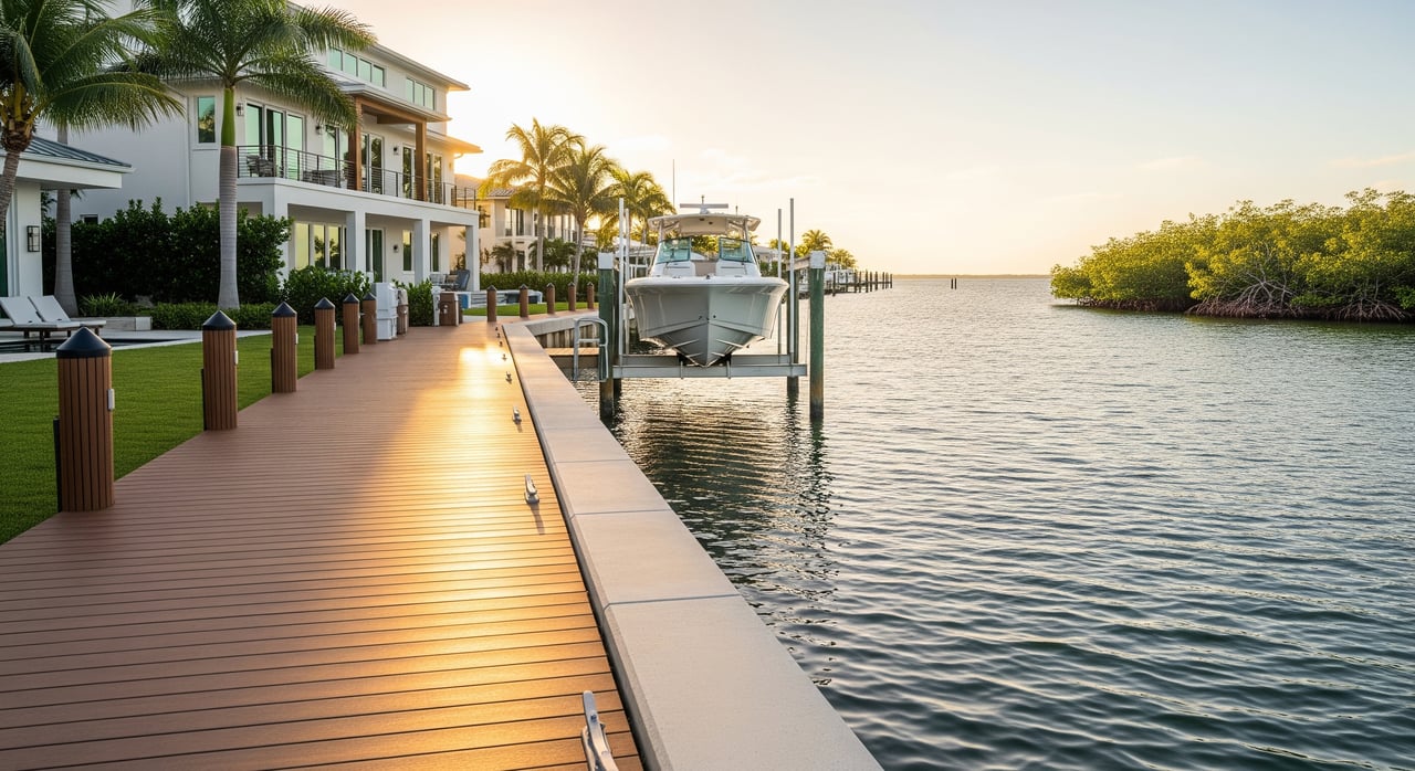
What “deep-water” really means
“Deep-water” is a marketing term, not a legal standard. What counts as “deep” depends on your boat’s draft and the lowest water conditions you will encounter. Many larger yachts need roughly 6 to 10 feet at low water, while smaller center consoles or runabouts may need only 2 to 4 feet.
Do not accept “deep-water” without data. Ask for recent soundings or a depth survey tied to MLLW or MLW from the dock to a navigable channel and out to the bay. If you plan to install a lift, match lift height and cradle depth to the documented water depth and your vessel’s draft.
Draft and air draft
Your boat’s draft is how much of it sits below the waterline. Match this to the shallowest point on your route at the relevant tidal datum. Your air draft is the height above the waterline, which determines whether you can clear bridges.
If you have a flybridge or a tall hardtop, study bridge clearances as carefully as water depth. Even in calm water conditions, a single fixed bridge with limited clearance can block access for taller vessels.
“No fixed bridges” and bridge types
“No fixed bridges” means you will not pass under any bridges with a set, non-opening clearance on your way to the Gulf. This is helpful for sailboats, sportfishing boats with tall towers, and motor yachts with significant air draft. Bridge types include fixed, bascule or drawbridge, swing, and lift bridges, each with a posted clearance and an opening schedule.
Confirm every bridge between your dock and open Gulf waters. Movable bridges add convenience but can affect timing and routine. Fixed bridges limit air draft forever, so double check height and tides before you buy.
Legal rights and shoreline structures
Riparian and littoral rights
If your property touches navigable water, you typically have riparian or littoral rights, such as reasonable access and the ability to pursue water-dependent structures. These rights are subject to state and county rules and the public trust doctrine. They do not guarantee approval for any specific dock or lift.
Before you rely on an assumed right to build, replace, or expand a dock, ask for the permit history and any as-built drawings. Confirm there are no recorded easements or shared-use agreements that alter how you can use the shoreline.
Sovereign submerged lands
In Florida, the state usually holds title to submerged lands below the tidal boundary. Many docks, pilings, and lifts extend over state-owned bottoms, which introduces additional permitting layers. You may need approvals from state and county agencies for new or modified structures.
When you review a survey, look for the mean high-water line and any notes on accretion or erosion that could shift boundaries. For complex waterfronts, a local maritime attorney or surveyor can help interpret tidal boundaries and recorded rights.
Docks, seawalls, and shoreline armoring
Most docks, lifts, and seawalls need permits before construction or replacement. In areas with seagrass or manatee habitat, you may also see special conditions, mitigation, or construction windows that reduce impacts. Expect inspections and final approvals to be part of a complete permit file.
Seawalls can help protect uplands but also affect how neighboring shorelines behave. Some programs promote living shoreline strategies in suitable locations. If a seawall is older, budget for condition reports and potential repairs.
Risk, permits, and insurance
Permitting landscape on Siesta Key
Multiple agencies have a say in coastal work. Expect to coordinate with Sarasota County for coastal construction rules and records, state environmental authorities for submerged lands and environmental protection, and federal agencies for certain in-water work. Bridge operations and posted clearances fall under federal oversight.
Neighborhood and condominium rules can add another layer. Review HOA covenants, dock usage policies, and any boat size or noise rules. For a clean closing, make sure all past shoreline work is properly permitted and closed out.
Environmental protections and boating constraints
Seagrass beds and manatee habitats are common in Sarasota Bay. You may see no-wake or speed zones, propeller protection efforts, and limits on where docks can be sited. If mangroves line your lot, trimming and removal are regulated and often require authorization.
These protections help preserve water quality and local wildlife, and they also shape your daily boating routine. Plan routes that respect speed zones and be realistic about how tides and seagrass coverage affect your draft.
Flood zones, storm surge, and sea level
Many waterfront parcels fall in FEMA Special Flood Hazard Areas such as Zones AE or V. That influences building elevation requirements, insurance options, and lender conditions. Gulf-facing homes often face higher surge and open-ocean wave energy, which can affect design standards and carrying costs.
Long-term planning should factor in sea-level rise and local resilience efforts. Ask for the property’s elevation certificate if one exists, and understand how finished-floor elevation compares to current requirements.
Insurance and financing
Waterfront ownership usually means higher costs for flood and wind coverage. Premiums and availability change with market trends, building elevation, and storm history. Lenders often require flood insurance for high-risk zones and will scrutinize permit files for any water-dependent structures.
Appraisers typically evaluate water access, permitted docks and lifts, flood elevation, and comparable sales. Unpermitted structures or unclear channel maintenance can delay underwriting and cause pricing friction.
Public access, beach use, and coastal rules
Public beach access points, operations, and parking can shape your day-to-day experience near popular stretches of sand. Coastal setback lines and dune protections limit how close you can build to the Gulf. If your lifestyle vision includes new decks or cabanas near the beach, verify what is allowed before you buy.
For condominium buyers, confirm building rules on beach gear, guest access, and on-site slip assignments. These details affect both enjoyment and resale.
Quick buyer checklist for Siesta Key
Use this short list when touring waterfront homes:
- Request a recent survey that shows tidal boundary lines and the current mean high-water line.
- Ask for permits and as-builts for docks, lifts, and seawalls. Verify county and state approvals are complete.
- Get a recent depth survey with soundings tied to MLLW or MLW from the dock to the navigable channel.
- Confirm whether access channels are public or private, who maintains them, and the last dredge date.
- List every bridge to the Gulf with type, posted clearance, and whether it opens on a schedule.
- Obtain the flood zone determination and any elevation certificate for insurance planning.
- Review documents on riparian or littoral rights and any recorded easements affecting water access.
- Ask for shoreline condition reports, erosion history, and any pending coastal applications.
- Read HOA or condo rules for docks, boat sizes, and slip assignment policies.
Real-world scenarios to test fit
The 40-foot express cruiser
You plan to keep a 40-foot express cruiser that draws around 3 to 4 feet and has a tall hardtop. You need documented depths of at least 4 feet at the lowest tidal conditions from your lift to the bay, with a margin for safety. You also need “no fixed bridges” or a clear bridge plan with adequate opening schedules and posted clearances.
If a canal shows 3 feet at MLW at the most restricted point, the boat may be impractical there. Look for deeper bayfront parcels or maintained channels with reliable dredge records.
The paddleboard and flats skiff lifestyle
You picture sunrise paddles and occasional flats fishing in skinny water. A bayfront home with mangrove fringe and a thoughtfully sited low-impact dock can fit perfectly. You still want a depth survey, but draft requirements are modest, and speed zones nearby can make for calmer, safer outings.
Be sure to ask about seagrass coverage and any dock lighting or design requirements that protect habitat.
The family beach house with seasonal boating
A Gulf-front home delivers beach life front and center, while boating happens from a rented slip or a canal-side guest house. If you want both beach and a private dock, explore parcels that span to the bay or consider a bayfront home with quick runs to the Gulf. In either case, verify flood zone, wind coverage, and coastal setback limits early in your search.
How the terms guide your decision
- Direct Gulf access and no fixed bridges make large offshore boats easier to own but usually come with higher exposure to wind and surge.
- Bayfront and canal properties offer calmer water and great paddling, often with more navigational variables to confirm.
- Deep-water claims need proof at a known tidal datum. Match the shallowest point on your route to your boat’s draft.
- Riparian rights and properly permitted docks determine what you can use today and what you can replace later.
- Flood zones and insurance shape carrying costs and resale considerations.
If you learn the language and verify the numbers, you can buy with confidence and enjoy the waterfront lifestyle you have in mind.
Ready to talk through a specific property, bridge route, or dock plan on Siesta Key? Reach out to the local experts who live and breathe this coastline. Connect with The Ackerman Group for clear guidance and a tailored search.
FAQs
What does “no fixed bridges” mean for Siesta Key boating?
- It means your route from the property to the Gulf has no non-opening bridges limiting air draft, though you should still confirm the types, clearances, and opening schedules of any movable bridges.
How deep is “deep water” for my boat near Siesta Key?
- It depends on your boat’s draft, but many larger recreational boats need roughly 6 to 10 feet at low water while smaller boats may need 2 to 4 feet, all verified at MLLW or MLW.
Why does MLLW vs MLW matter for dock depth?
- Depths tied to a known tidal datum prevent surprises at low tide, so always request which datum was used and ask for recent soundings along the route to open water.
What permits are needed to build or replace a dock?
- Expect county and state approvals and, in some cases, federal review for in-water work, with added conditions if seagrass, manatee habitat, or mangroves are present.
How do flood zones affect a Siesta Key home purchase?
- Flood zones influence insurance requirements, premiums, and building elevation standards, so request the flood zone determination and any elevation certificate early.
Who maintains canal depths and pays for dredging?
- Some channels are publicly maintained while others are private, so verify maintenance responsibility, timing, and cost sharing before you rely on specific depths.